Konya, Türkiye
Project Type
City Planning and Master Plan
Location
Konya, Türkiye
Year
2022
Project Service
Master Plan
Project Status
Concept Project
Total Area (m²)
4780686.00
Total Construction Area (m²)
2250931.00
Employer
Republic of Turkey Ministry of Environment, Urbanization and Climate Change
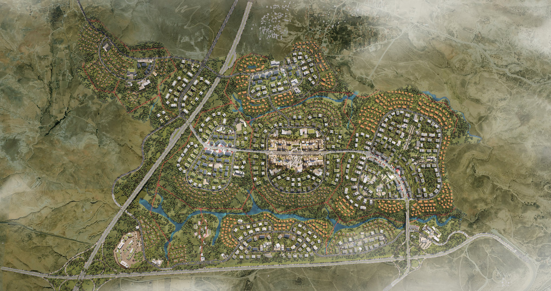
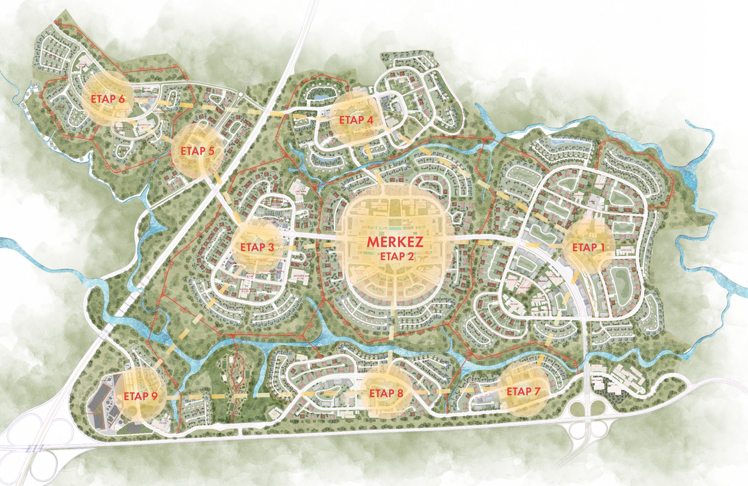
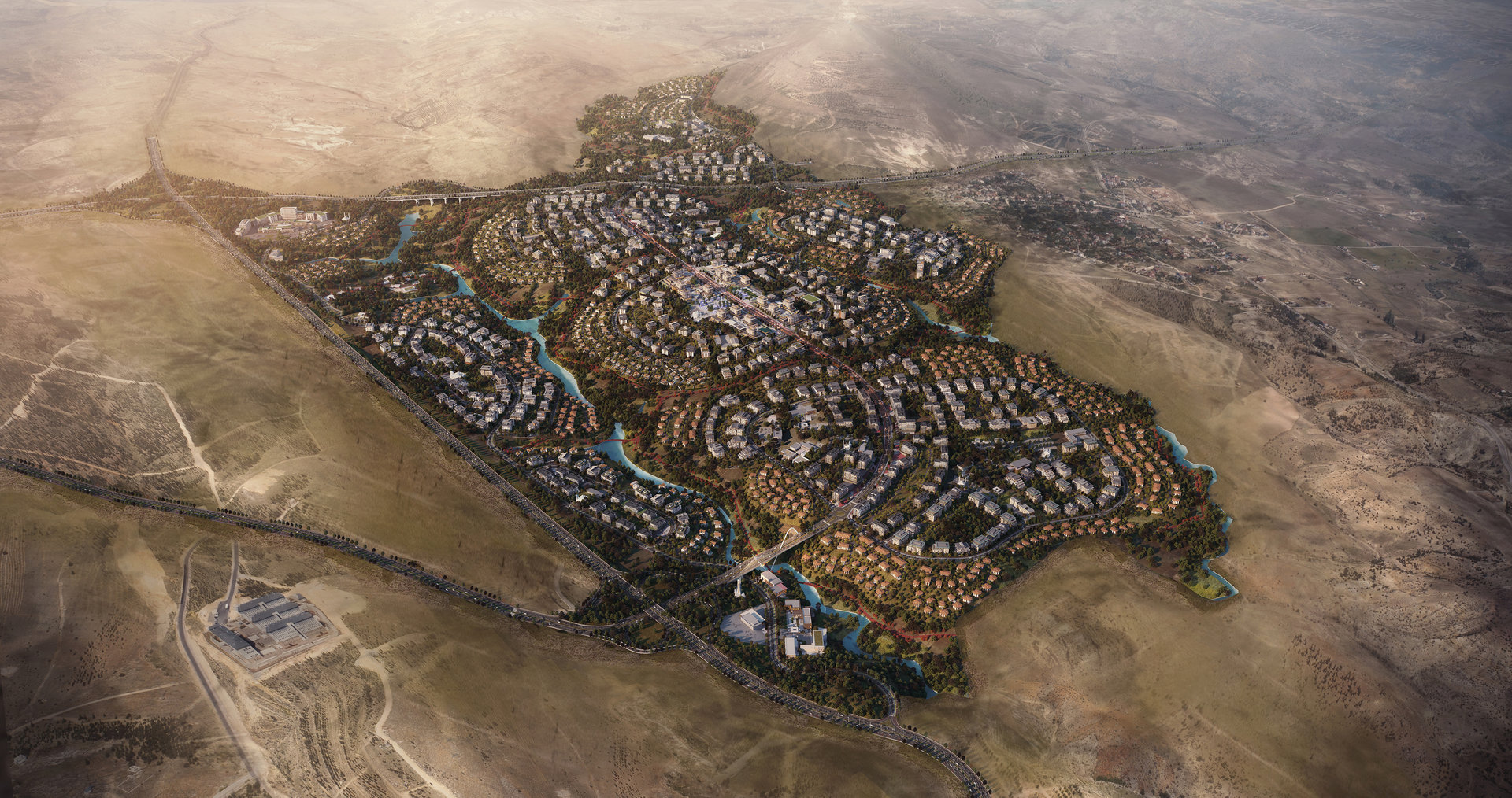
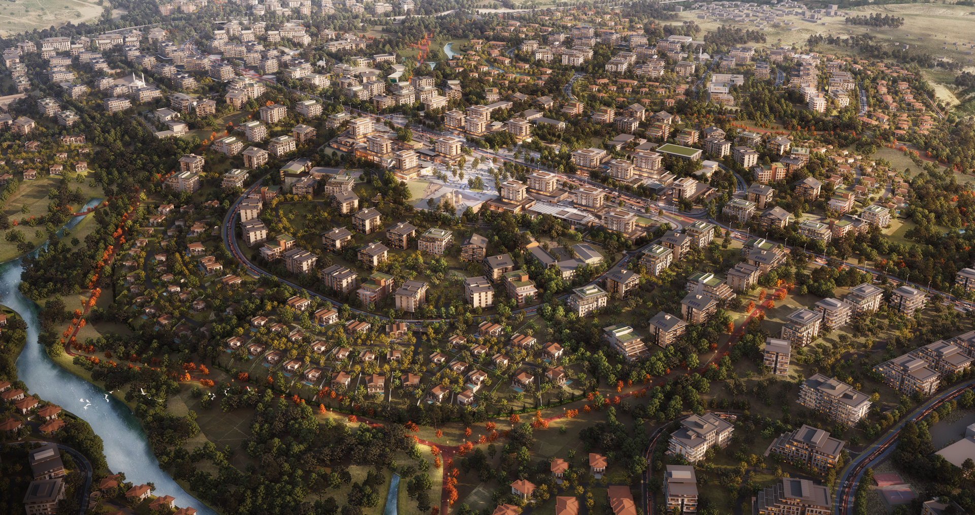
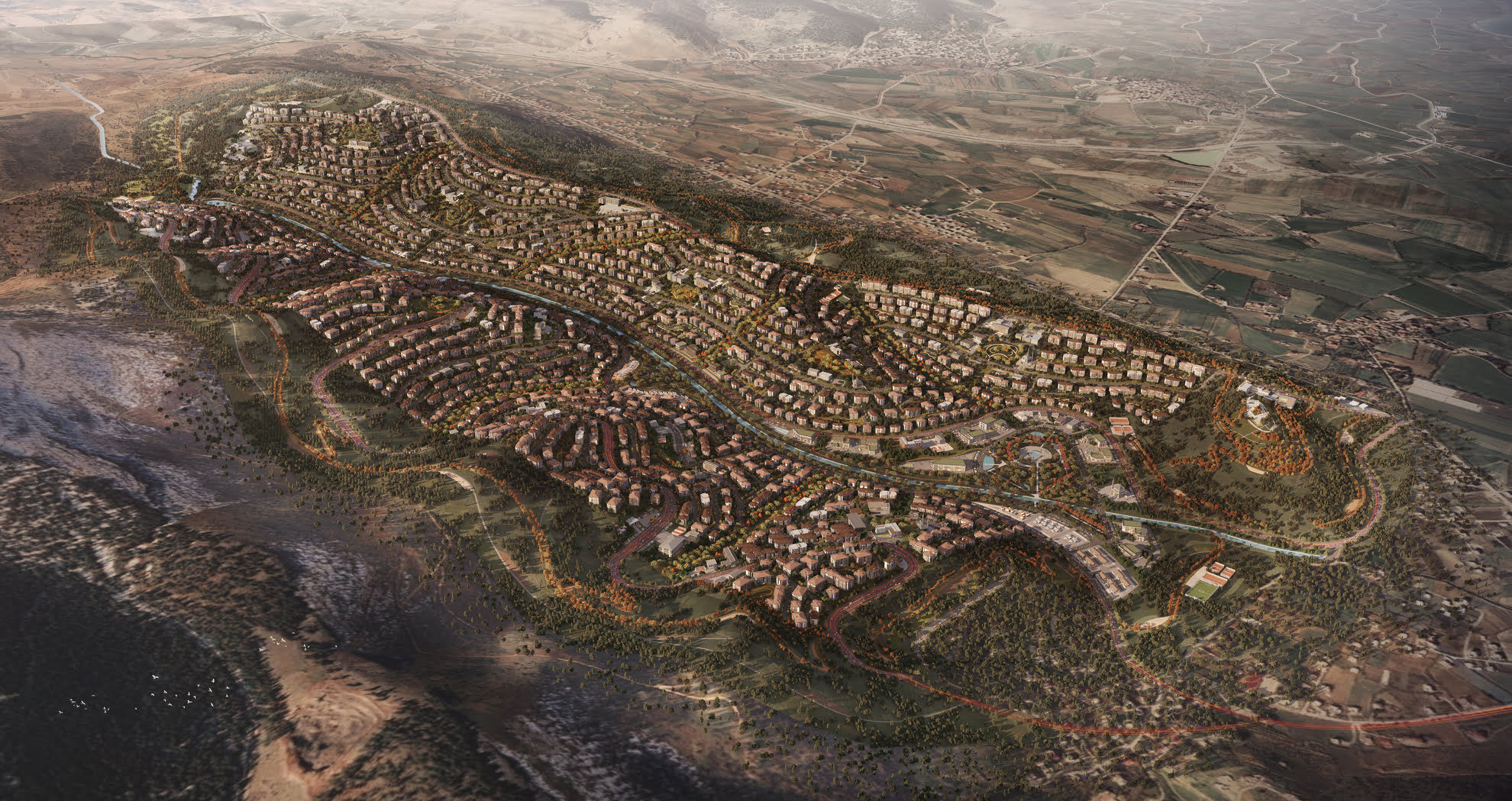
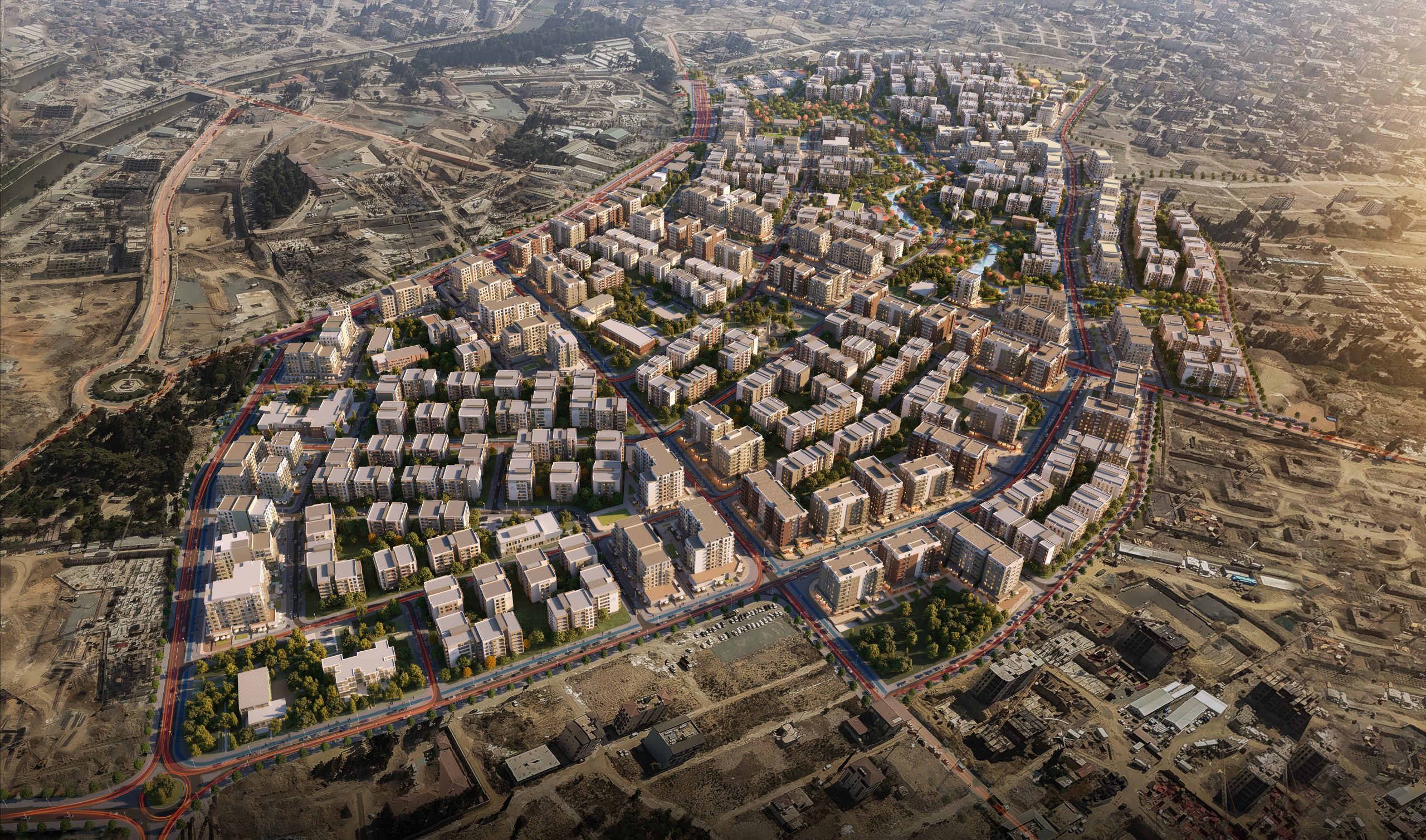
Located west of Konya within Selçuklu District, the Sarayköy Masterplan project spans approximately 480 hectares between the Sarayköy Road and the D330 Konya–Beyşehir Highway. The site lies just 9 kilometers from the city center and remains untouched by any existing development. The planning area gains significance from its proximity to historical landmarks such as Takkeli Mountain and Gevale Castle, and it lies adjacent to institutional anchors like Necmettin Erbakan University and the Faculty of Medicine Hospital.
Contextual Integration and Access Strategy
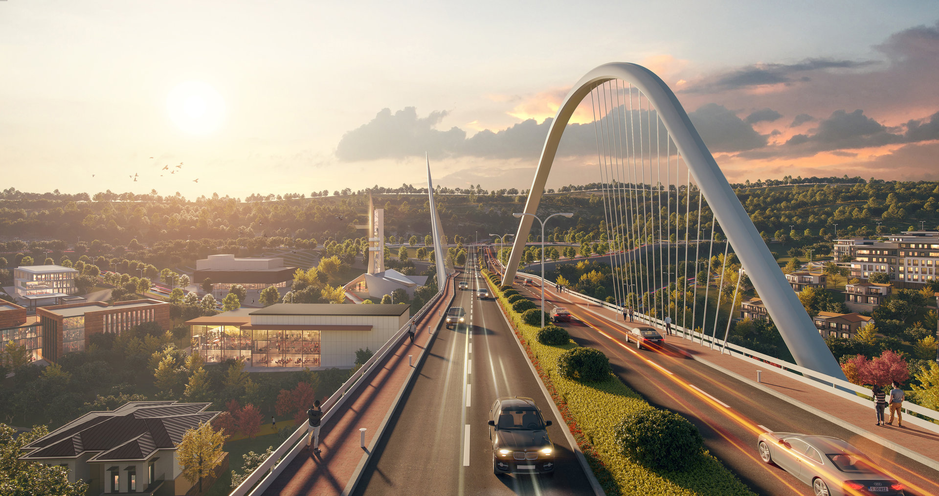
The project integrates with regional transportation through existing and planned roads, providing direct access to major arteries such as Beyşehir Street and Saray Street. Two seasonal streams that traverse the site are managed via a northern water channel, guiding runoff outside the urban boundary.
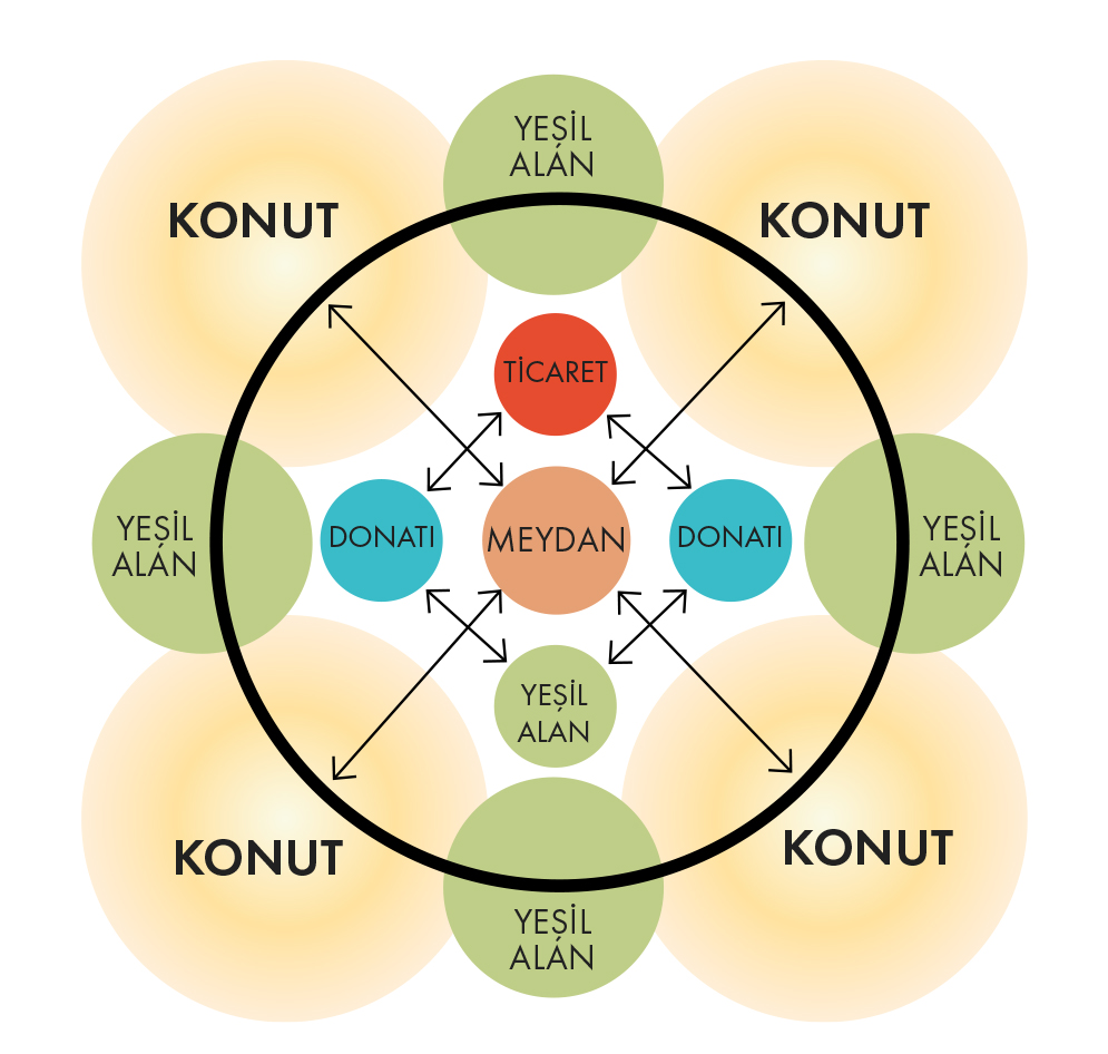
Planning Principles and Zoning Structure
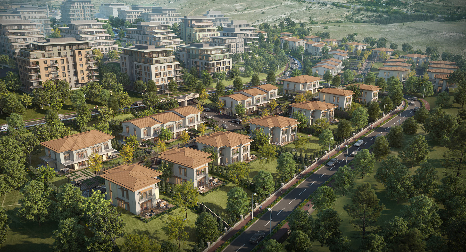
The design is built on the principles of self-sufficient neighborhood clusters, where social facilities, parks, plazas, and commercial functions are distributed in a layered, accessible manner. Functional zones such as educational campuses, healthcare facilities, markets, religious centers, cultural venues, and sports areas are positioned with equal proximity to residential units. Approximately 56% of the area is allocated to housing parcels, while 44% is reserved for public services and amenities.
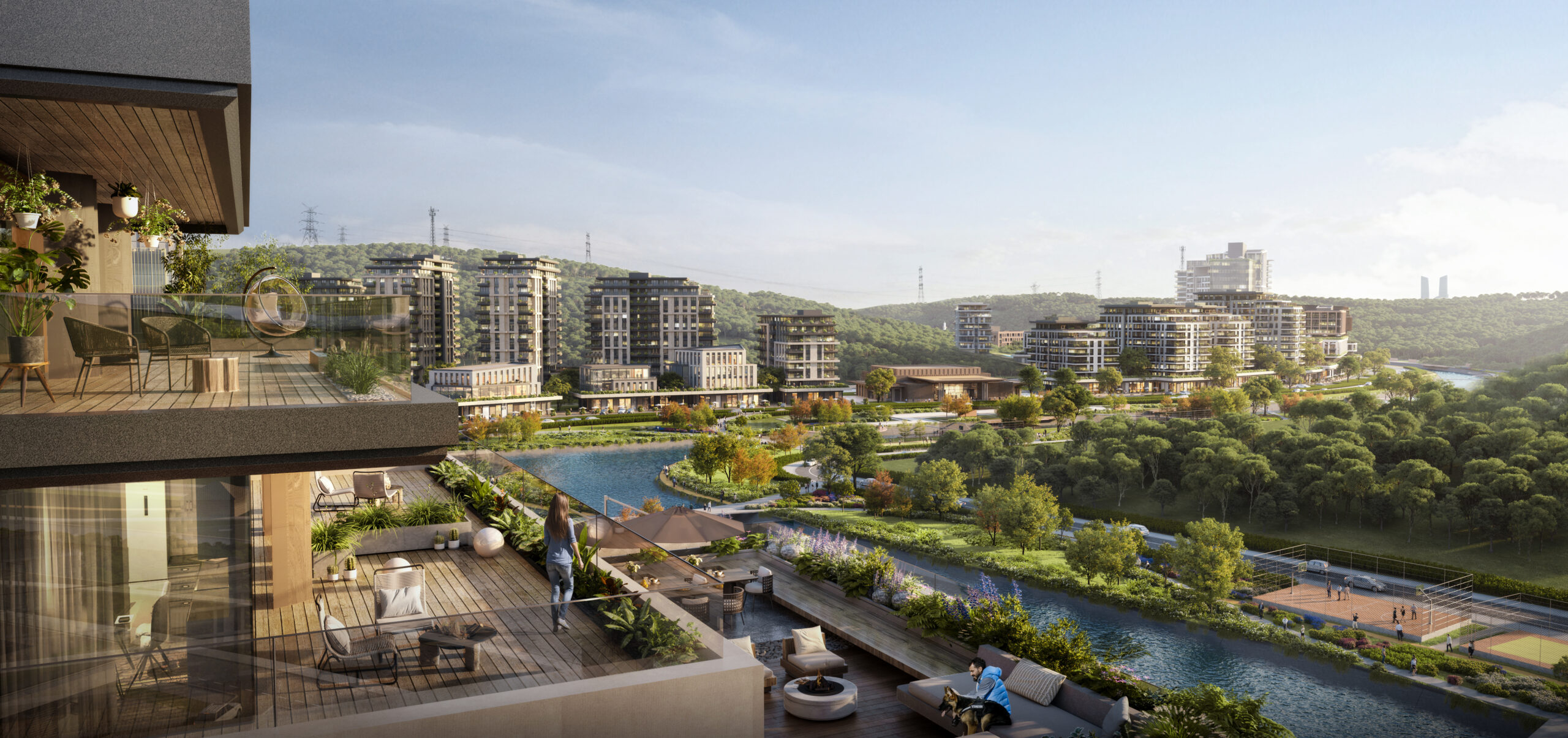
Landscape-Sensitive Settlement Strategy
Topographic and geological surveys identified slope stability, seismic conditions, and unsuitable zones along the creek beds. These areas were preserved and enhanced through afforestation and turned into green corridors. Settlement decisions were guided by natural thresholds and optimized for views and terrain advantages, creating a balanced dialogue between built and open spaces.
Gallery