İstanbul, Türkiye
Project Type
City Planning and Master Plan
Location
İstanbul, Türkiye
Year
2016
Project Service
Master Plan to Construction
Project Status
Ongoing
Total Area (m²)
3762847.00
Total Construction Area (m²)
4500000.00
Employer
OYAK Construction
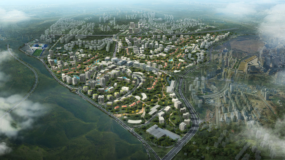
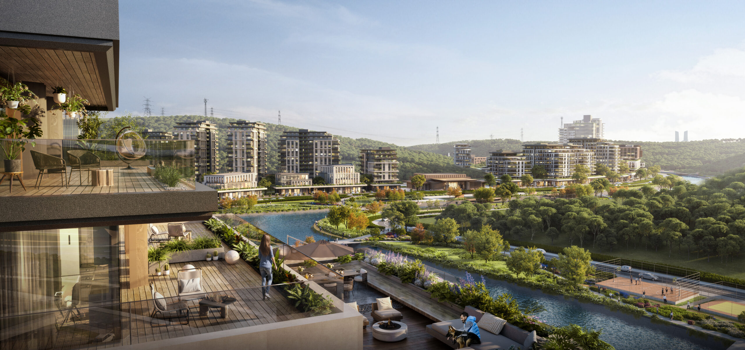
Situated in the Başakşehir district on Istanbul’s European side, the Oyakkent Masterplan unfolds over a vast 3.73 km² area, integrating residential, commercial, educational, and healthcare functions into a holistic urban environment. With 73% of its surface dedicated to landscaped green areas, the project establishes a new model of environmentally conscious development, where ecological balance and human well-being are brought to the forefront of design.
Urban Context and Strategic Position
The site is located in Başakşehir Mahallesi, a rapidly growing northern settlement, positioned within Istanbul’s 2nd-degree seismic zone. Surrounded by vital hydrological resources Sazlıdere Dam, Büyükçekmece and Alibeyköy basins the area benefits from rich groundwater reserves, while also demanding resilience against natural risks. The masterplan responds to these conditions with a strategic approach that prioritizes seismic safety, ecological sensitivity, and long term adaptability.
Functional Program and Spatial Organization
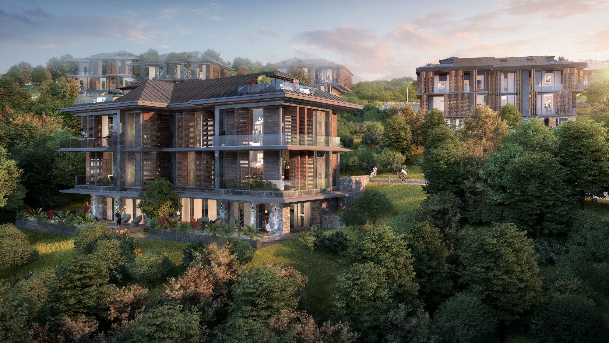
The design introduces a mixed-use urban core supported by housing clusters, commercial boulevards, and social facilities. In addition to residential and retail areas, the masterplan accommodates schools, hospitals, cultural amenities, and recreational spaces, aiming to create a self sufficient urban ecosystem. Housing typologies are distributed across the valley topography: lower-rise blocks positioned toward the inner green corridors, and high-rise buildings placed on the peripheries to maximize views and daylight.
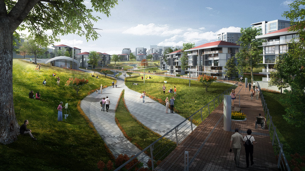
Landscape and Public Realm Strategy
Inspired by the valley morphology, the project reinforces ecological continuity with interconnected green corridors, pedestrian promenades, and community gardens. Landscape networks extend across the site, merging with circulation bridges and creating a fabric where built environment and topography coexist. Overall, 95% of the land is structured as common, collective, or green space cultivating not only environmental value but also a sense of neighborhood culture.
Infrastructure, Mobility, and Connectivity
Positioned near the Third Airport, Yavuz Sultan Selim Bridge, and Northern Marmara Motorway, the site benefits from high regional accessibility. Within the masterplan, additional connections such as tram and monorail systems are proposed, linking housing units to commercial and social hubs. This integrated mobility network strengthens accessibility across scales, from local neighborhood movements to international connections.
Environmental Sustainability and Technical Systems
Sustainability is embedded into the masterplan with advanced resource-management strategies:
• Water cycle systems: wastewater treatment, rainwater harvesting, and groundwater utilization for irrigation and greywater reuse.
• Renewable energy: photovoltaic panels integrated into building roofs to reduce reliance on external energy sources.
• Material reuse: excavation soil repurposed as structural fill, reducing ecological footprint.
• Hydrological resilience: culvert systems positioned to maintain natural water flows without altering stream beds.
These measures establish a self-sustaining model of urban resilience, aligning daily life with environmental stewardship.
Conclusion
The Oyakkent Masterplan is not only a large scale urban development but a replicable model of resilient city making in Istanbul. By integrating ecological infrastructure, diverse programs, and strategic transport networks, the project demonstrates how environmental consciousness, social vitality, and metropolitan growth can be reconciled within a singular, forward looking vision.
Gallery