Istanbul, Türkiye
Project Type
City Planning and Master Plan
Location
İstanbul, Türkiye
Year
2024
Project Service
Master Plan
Project Status
Concept Project
Employer
Artaş Construction
Tags
Waterfront Development
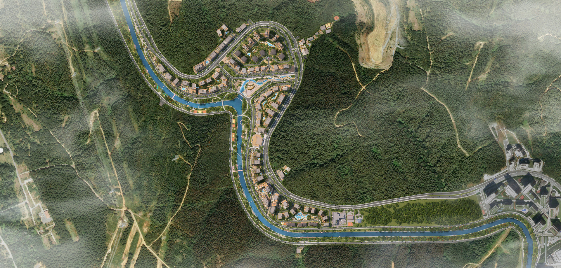
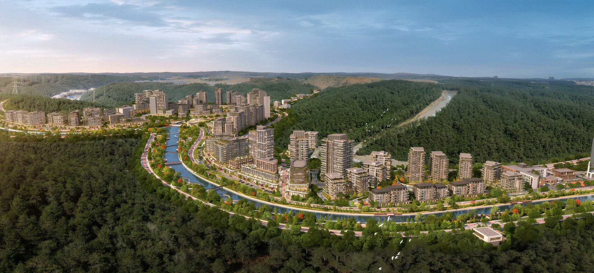
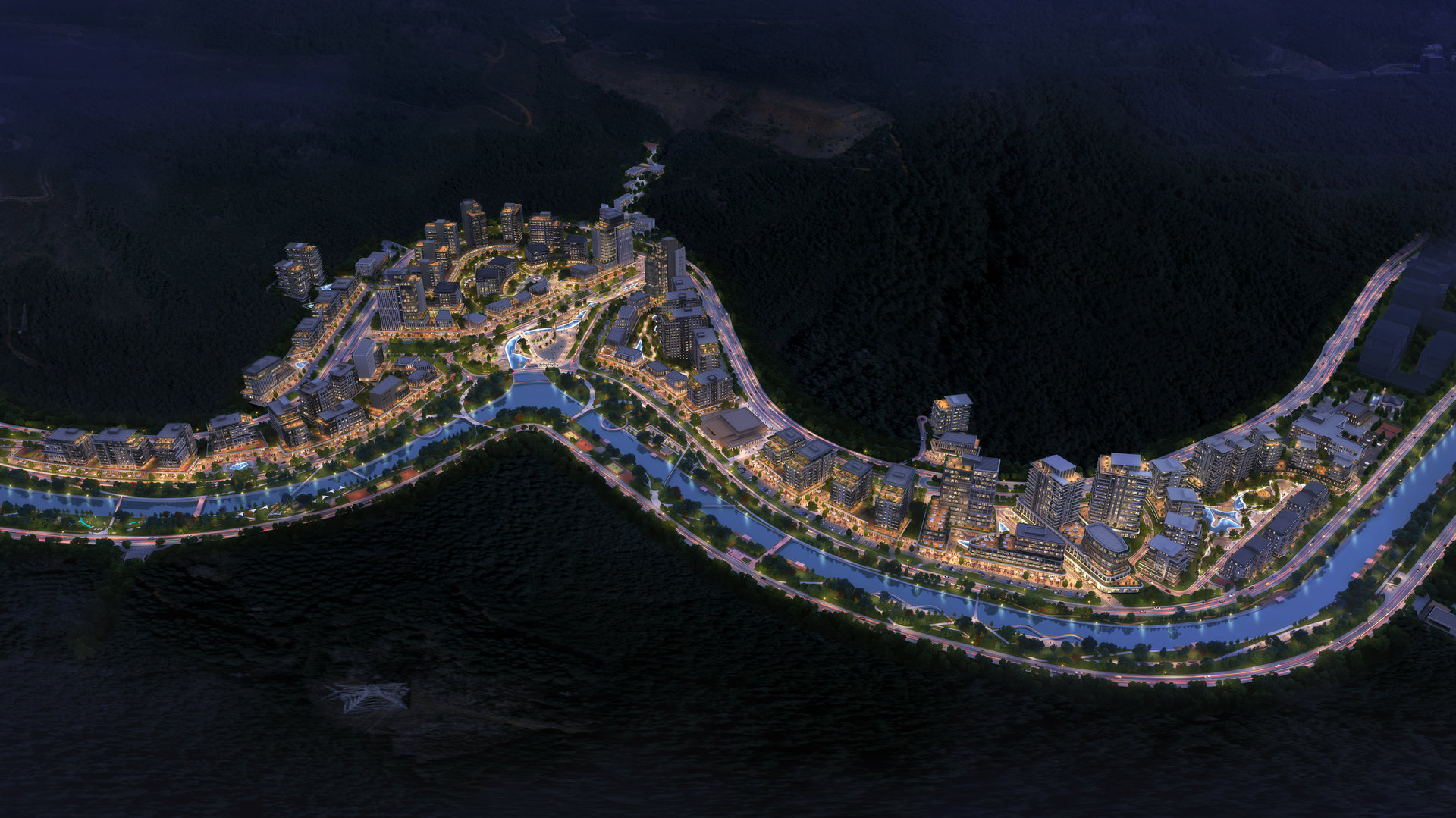
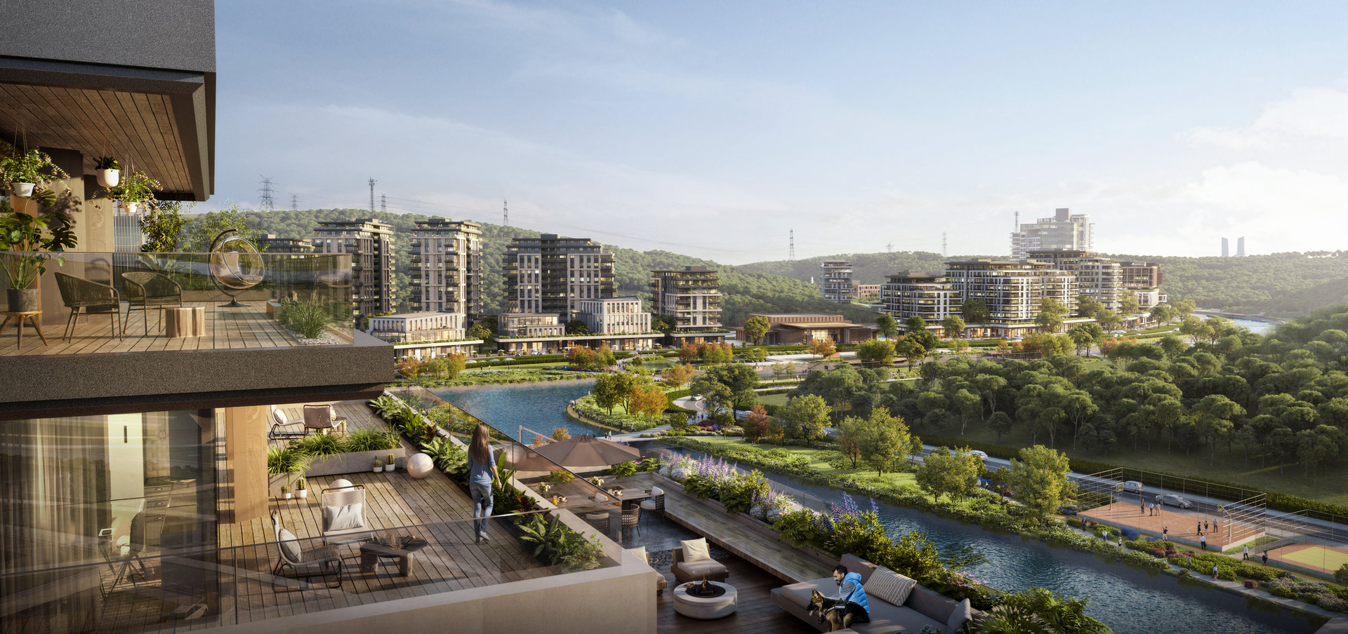
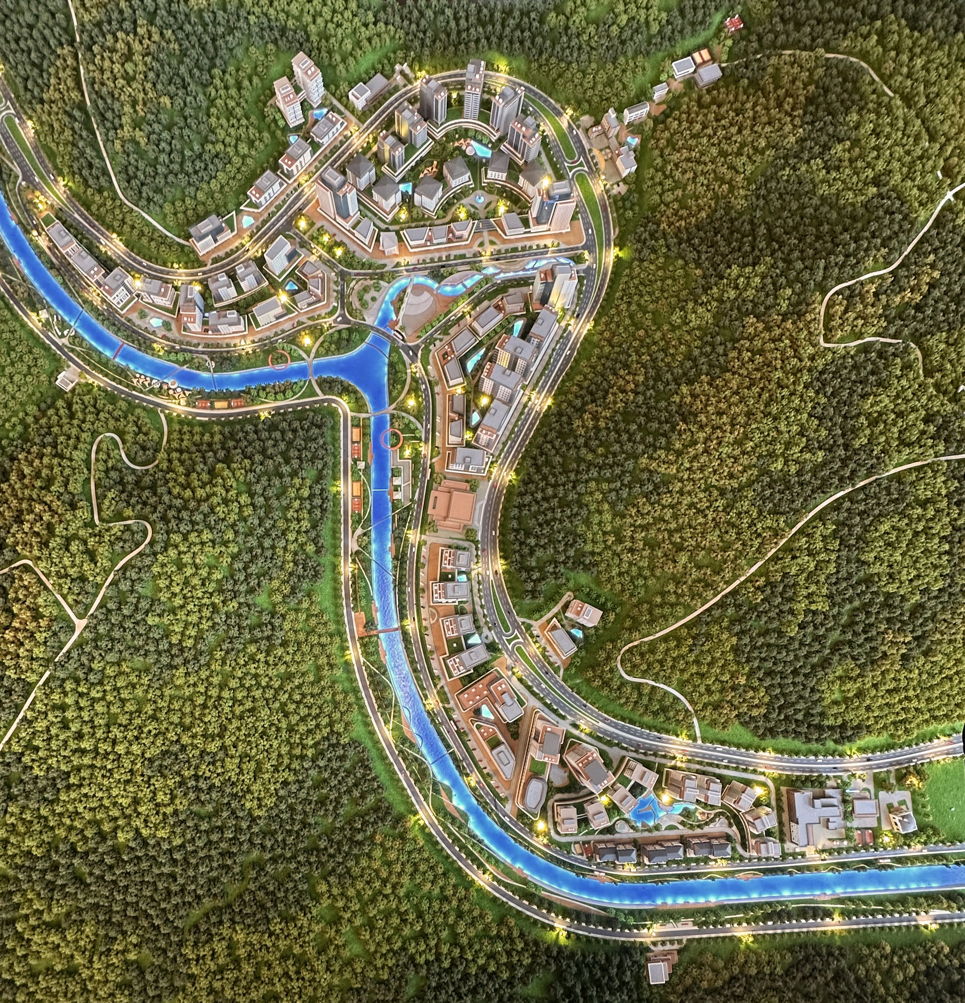
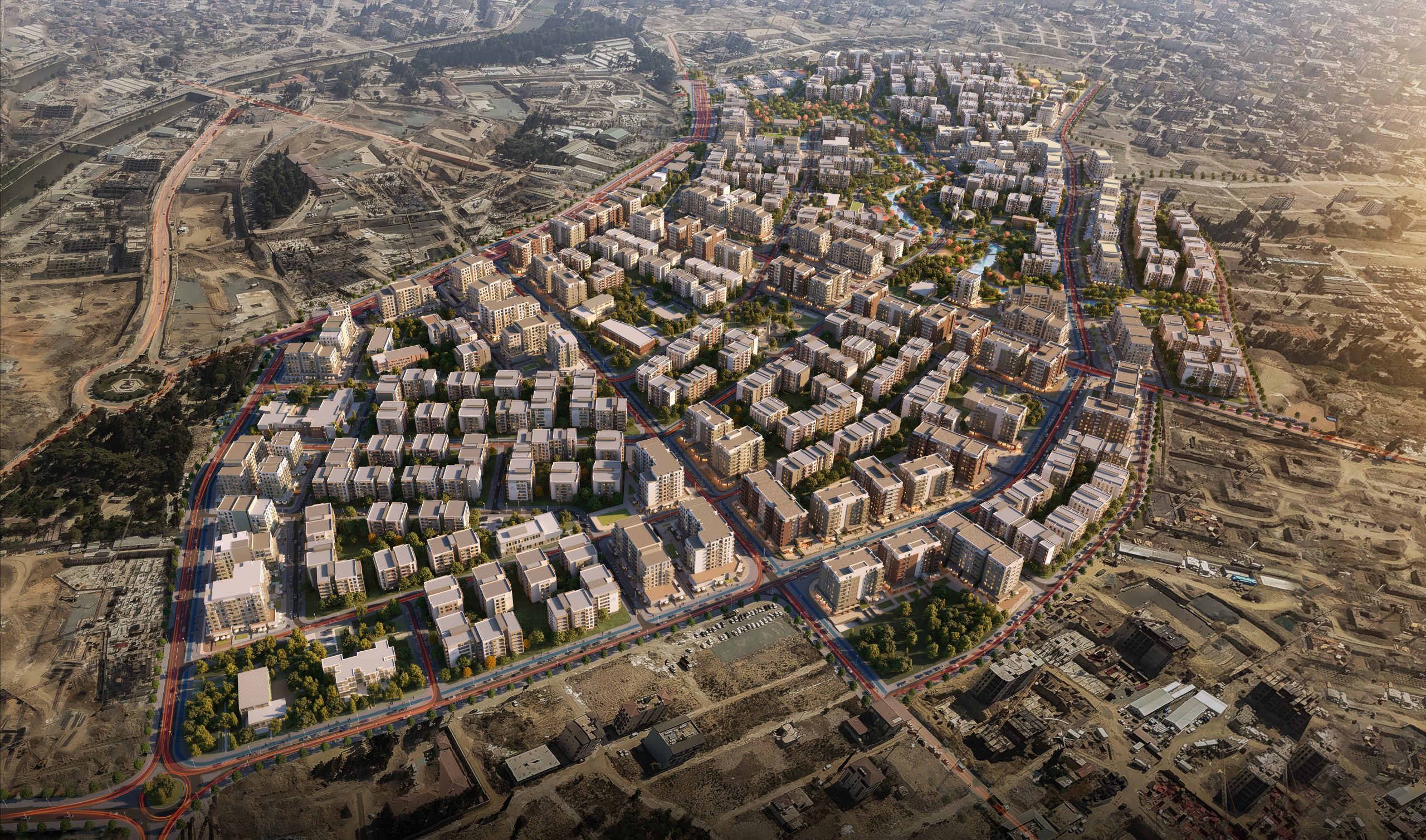
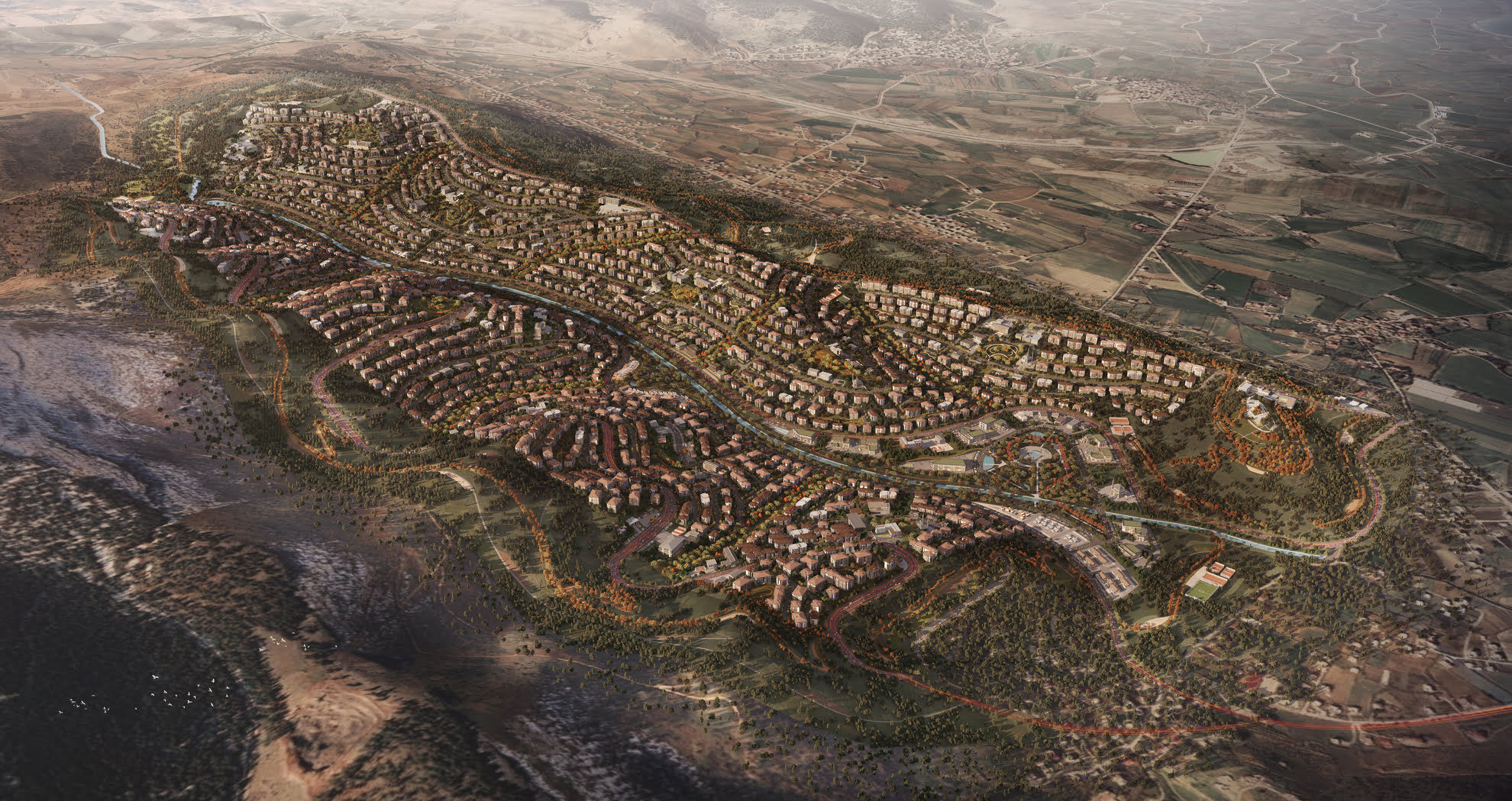
Located in the Cendere Valley—where the natural topography of water and slopes defines the character of the land—the Artaş Cendere Masterplan reimagines an urban future grounded in ecological memory, functional clarity, and sectional coherence. Framed by a stream that has historically shifted from agricultural to industrial and now commercial use, the site holds a layered urban narrative.
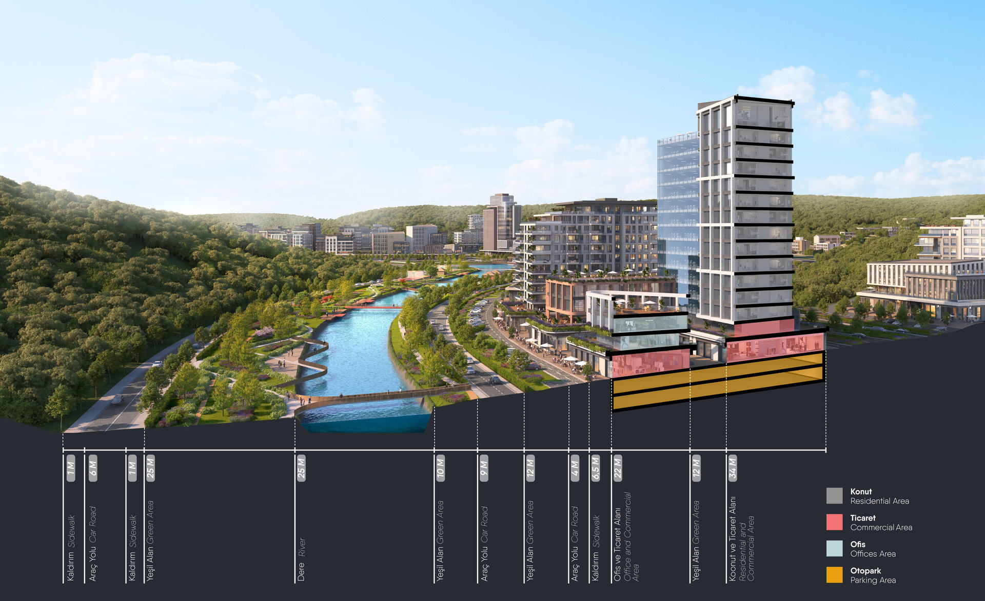
A Sectional Urban Strategy Anchored in the Valley
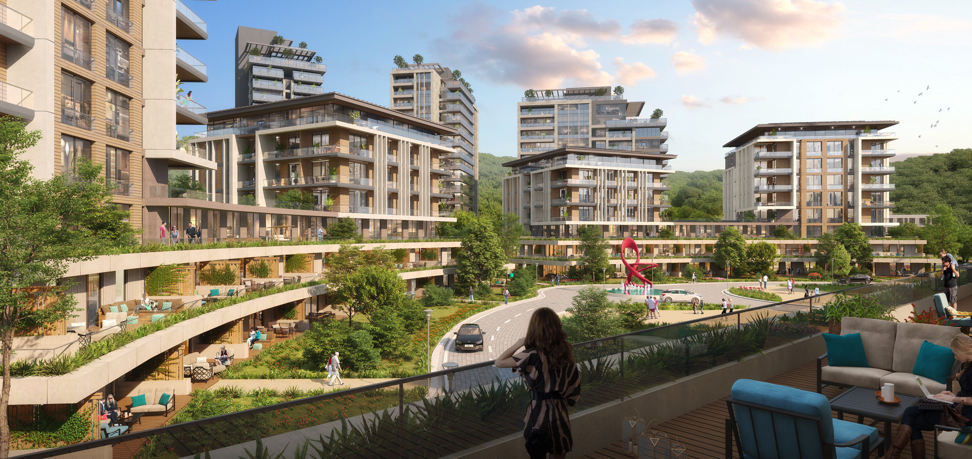
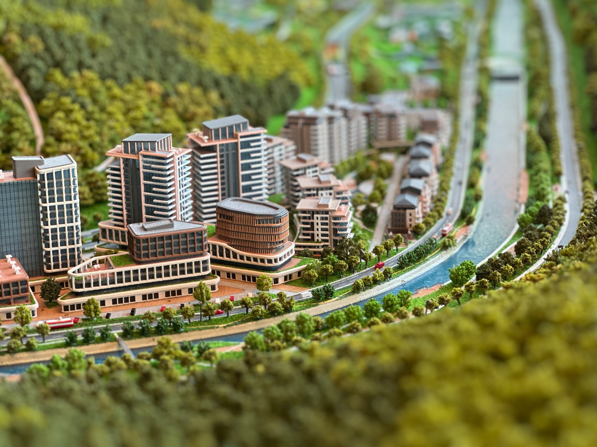
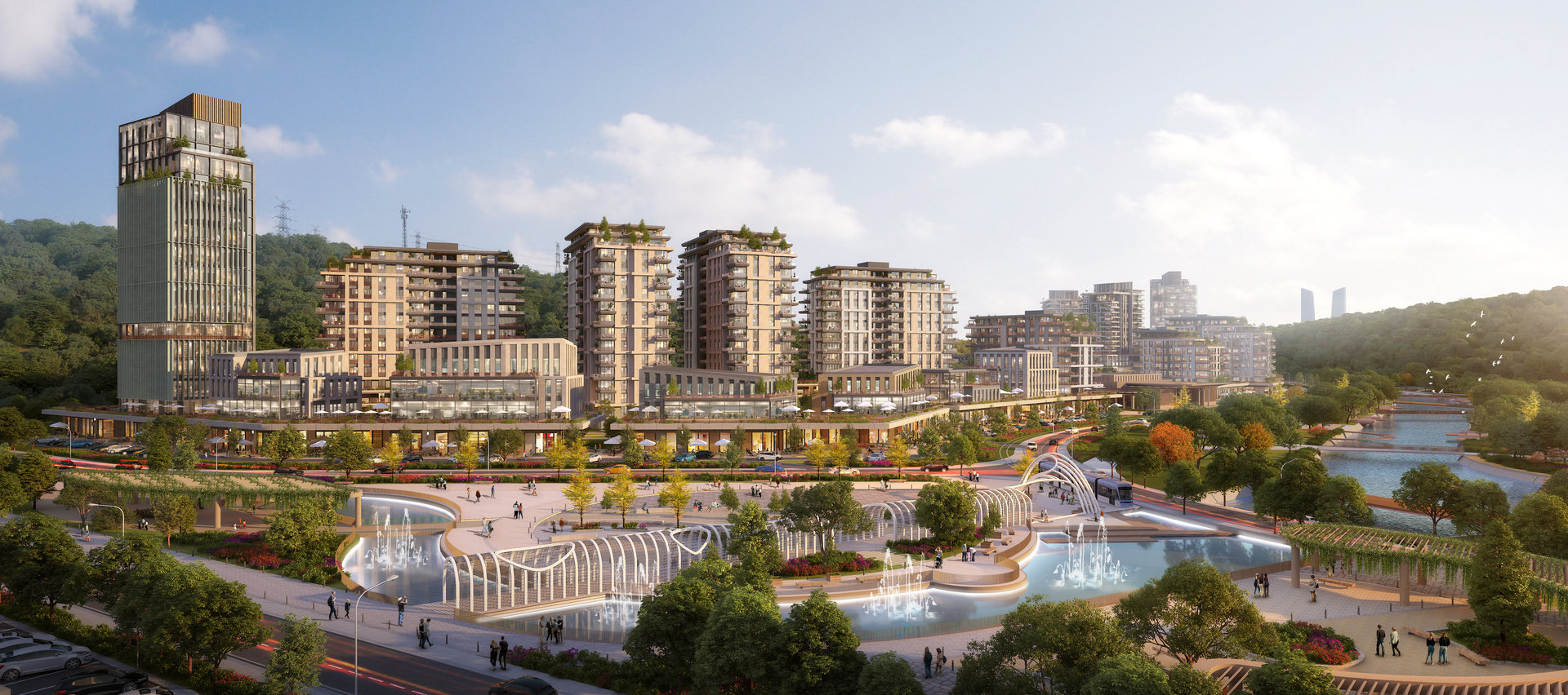
At the core of the design lies a sectional approach that responds to the valley’s natural slope and the stream’s ecological corridor. The plan articulates a gradual building height increase from the valley base outward, allowing sunlight, vistas, and air to penetrate the entire urban tissue. Key programs—residential, office, commercial, educational, cultural, and health—are arranged along this slope-based hierarchy, each respecting the topographical flow. The river becomes the site’s experiential backbone, bordered by linear green belts and walking promenades. Bridges, ecological crossings, and riverside plazas create a continuous relationship between urban and natural systems.
Mass Placement and Functional Zoning
The massing strategy is driven by three primary criteria:
1.Alignment with topographical traces, ensuring minimum intervention to existing slopes.
2.Valley-facing orientation, maximizing the interaction with green and water.
3.Integrated vertical programming, where commercial functions activate ground levels and residential/office functions occupy upper tiers.
The project features a hybrid section with distinct urban layers: underground parking, a commercial base, and a vertical mix of housing and office towers above. This creates not only spatial efficiency but also a dynamic skyline deeply rooted in its landscape context.
Public Space Logic and Square System
To enhance everyday public life, a hierarchy of squares has been implemented—each corresponding to the functional intensity of its surrounding context. These nodes of interaction serve as social condensers between housing clusters, retail pockets, and public institutions. The central square of each phase directs flow and ensures a legible, human-scaled experience.
Design Ethics and Environmental Continuity
- Low-rise educational and cultural buildings soften transitions and activate the base.
- Riverside recreation zones integrate sport, rest, and ecological learning.
- Green corridors extend the stream’s influence across the site, ensuring ventilation, biodiversity, and visual continuity.
- Functional edges are shaped to enhance street life while shielding private spaces.
Gallery