Giresun, Türkiye
Project Type
City Planning and Master Plan
Location
Giresun, Türkiye
Year
2021
Project Service
Concept to Construction
Project Status
Concept Project
Total Construction Area (m²)
17915.00
Employer
TOKİ
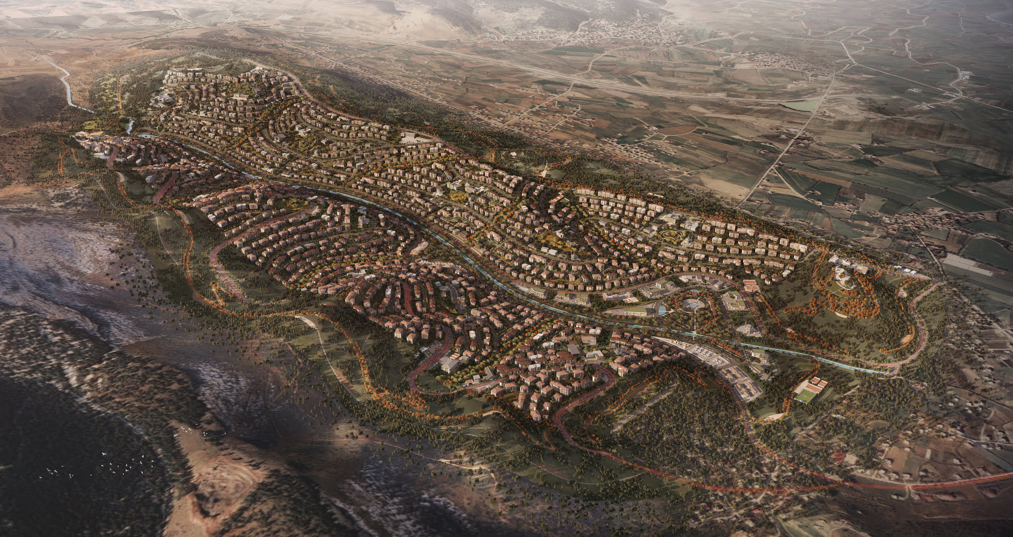
Located along the Aksu Valley in Giresun Province, the Dereli Urban Recovery Project emerges as a comprehensive spatial response to the catastrophic flood event of August 2020. The disaster, caused by intense rainfall and landslides, heavily affected Dereli and surrounding villages exposing the fragility of previous settlements and underscoring the need for resilient, terrain-conscious urban planning.
Dereli’s steep and rugged terrain, reaching elevations up to 3,000 meters, posed complex challenges in redefining the town’s spatial fabric. The project repositions the urban core by reestablishing safe construction zones, raising road elevations above flood thresholds, and removing structures obstructing the natural flow of the Aksu Stream. The result is a phased reconstruction model that integrates hydrological continuity, disaster risk mitigation, and civic reprogramming.
Organized into four development stages, the masterplan introduces new public institutions including a town hall, district police headquarters, primary schools, and a governor’s office alongside commercial kiosks and mixed-use residential blocks. Buffer zones, river setbacks, and newly elevated roads redefine the relationship between built form and landscape, allowing the water’s movement to reclaim its natural course.
Architecturally, the plan adopts a clustered, low-rise urban fabric inspired by regional vernacular and calibrated to the site’s hydrological sensitivities. Temporary commercial units are deployed in early stages to maintain economic activity during transition phases, while long-term civic anchors are constructed in consolidated, high ground parcels.